Vulnerability analysis and risk assessment
II: infrastructures and utility systems
Vulnerability analysis and risk assessment II: Infrastructures and utility systems
Modern societies and economies become more complex and sophisticated and, at the same time, more vulnerable to multiple hazards. Taking into consideration the rapid climate change, anthropogenic activities, growing urbanization, uncontrolled land-use and increased vulnerability of population and infrastructure, as well as interactions between different components of the urban system, the total risk is even higher. Therefore, the need to estimate the associated vulnerability and risk is of high importance towards the increase of society resilience and robustness to natural hazards. The Research Unit of SDGEE has a long experience in vulnerability and risk assessment projects as coordinator (SYNER-G) or major partner. Our expertise focuses on:
- Classification and inventorying of all elements at risk (buildings, lifelines, utility systems, transportation networks and infrastructures)
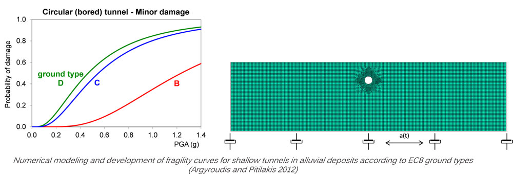
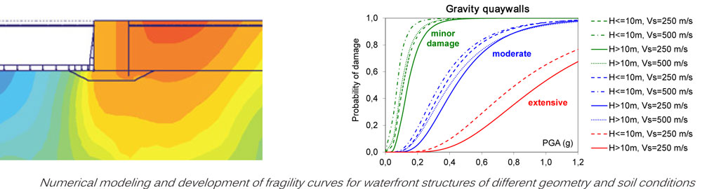
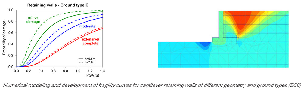
- Development of fragility curves for different hazards (earthquakes, landslides, liquefaction, tsunami)
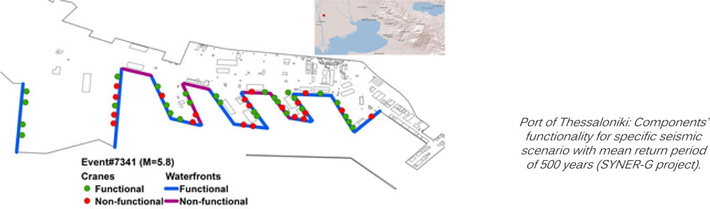
- Vulnerability and risk assessment based on detailed hazard analyses, considering site effects and induced phenomena at infrastructure, city or regional scale
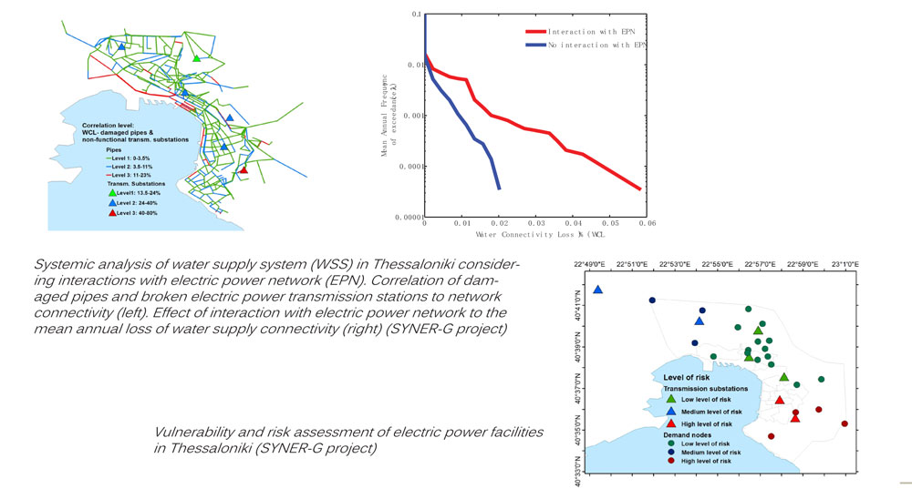
- Systemic and network analysis considering interaction between elements and systems
- Assessment of expected damages and losses, GIS mapping with damage distribution
- Socioeconomic losses. Damage restoration priorities and mitigation measures
STREST • SYNER-G • SAFELAND • REAKT • LESSLOSS • SRM-DGC • MERP • SRM-LIFE • RISK-UE
Selected publications:
• Pitilakis K, Crowley E, Kaynia A (eds), 2014, SYNER-G: Typology definition and fragility functions for physical elements at seismic risk. Series: Geotechnical, Geological and Earthquake Engineering, 27, ISBN 978-94-007-7871-9, Springer Netherlands.
• Argyroudis S, Selva J, Gehl P, Pitilakis K, 2015, Systemic seismic risk assessment of road networks considering interactions with the built environment. Computer-Aided Civil and Infrastructure Engineering, doi: 10.1111/mice.12136